
Finding a West Chester Township Street
For a West Chester Township street directory question, use the address as the anchor, not a name alone. Butler County keeps the parcel, the Recorder keeps recorded land instruments, and the Board of Elections releases voter material only through its lawful channels. Those sources have different meanings. The Auditor can identify a listed assessed owner and mailing address, but neither field proves that person occupies the parcel. A deed names parties to a recorded transaction, not every resident. A voter-related result or dated directory entry can add a time-specific lead, but it cannot fill the gaps left by protected records or unlisted household members.
- Enter the street number and street name in the Butler County Auditor Address Search, leaving off the suffix as the form instructs. Save the parcel PIN, situs address, listed owner, tax-mail fields, legal description, and transfer clues.
- Move from address to listed owner, while keeping the situs location separate from the tax mailing address. A matching mailing address may be useful context, but it does not prove occupancy.
- Use the owner and legal description in the Butler County Recorder Advanced Search to find the matching deed or other instrument. Record party role, document type, date, and number before following an earlier grantor or grantee.
- For a voter-compatible public source, check the current Butler Election Vault listing or an appropriate precinct-list channel. Its geographic files have release limits, and Safe at Home and other protected records must remain excluded.
- For a past household lead, use a dated criss-cross or street-guide entry where its geographic coverage fits, then preserve the volume year and page. A historic directory is evidence for that edition, not a current occupancy claim.
Address → listed owner → deed chain → voter-compatible public source → historic criss-cross or directory entry is a careful sequence. Each handoff should retain the parcel and date that made the comparison possible.
West Chester Township Street Directory Fields
The Auditor's address form is the practical first stop for street-by-street property research in West Chester Township. It accepts a Street Number and Street Name, with no Street, Drive, or Road suffix. An asterisk works as a wildcard, which can help when spelling is uncertain or a whole street needs a narrow property review. The portal also offers owner, parcel-ID, advanced, map, and sales modes. It displays a data-current date and lets the user sort a result set rather than treating the first match as final.
| Auditor field | Use on a street search | Format or choice |
|---|---|---|
| Street Number | Narrows a specific address | Use with Street Name when available. |
| Street Name | Finds a street or partial street | Do not enter the suffix; * is allowed. |
| Owners | Checks a listed owner after parcel review | LastName FirstName, no comma; full or partial text. |
| Parcel ID | Returns to one identified parcel | Use the exact county identifier. |
| Map Search | Moves from geography to a parcel | Use when the address form is ambiguous. |
| Sort by | Orders candidates for review | Parcel ID, Owner, Parcel Address, Roll, Transfer Date, or Sale Price. |
| Results per page | Controls review size | 10, 15, 20, 25, or 50 results. |
The Auditor's street-address screen is shown in this West Chester Township address-record reference image.
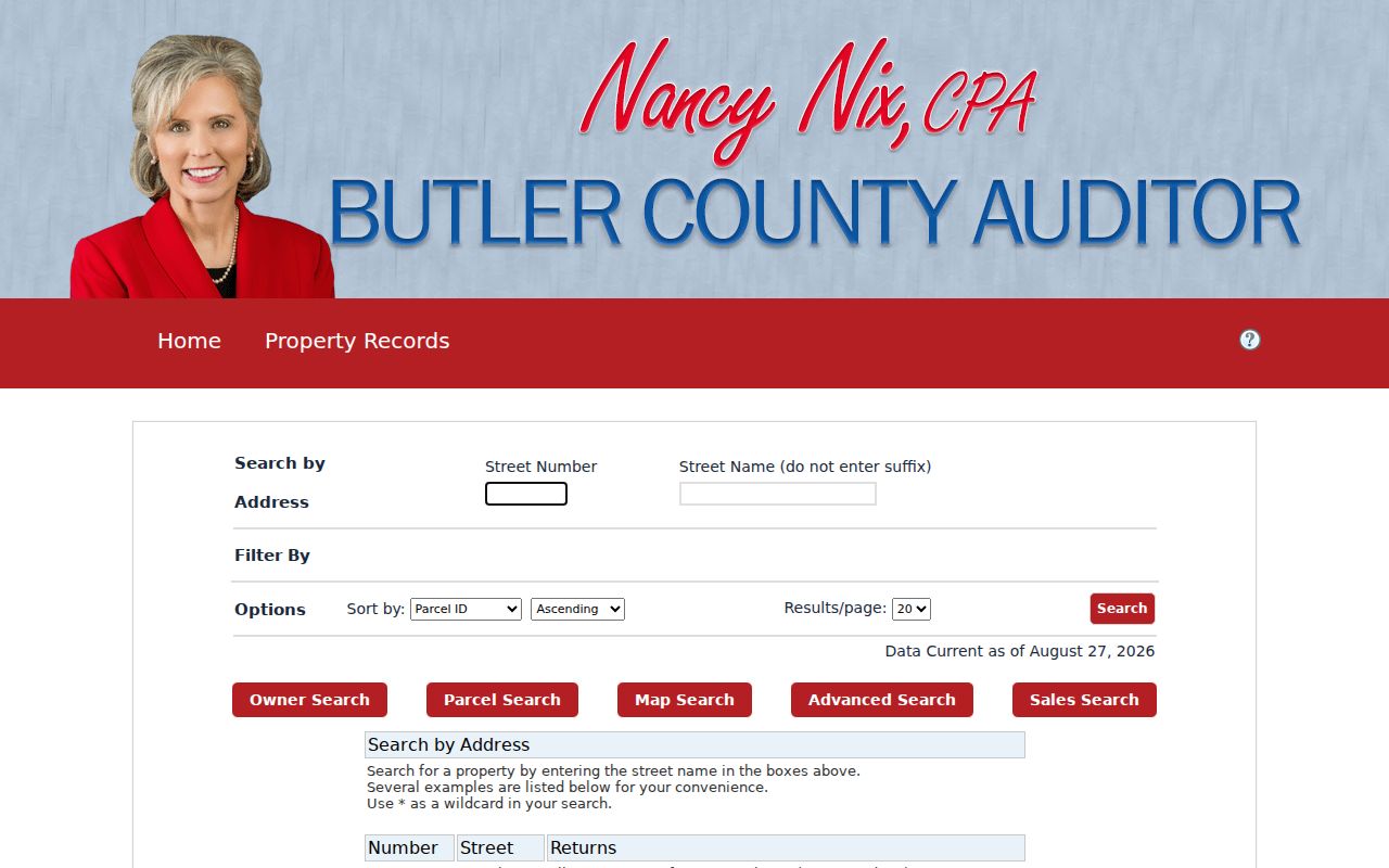
The screen supports a parcel-led review of a street. Its owner and address output should be read as assessment information, not as a household roster.
West Chester Township Street Parcel Profiles
Once a result is open, the parcel profile supplies the county keys that hold an address search together. PIN, old parcel ID, parcel ID, owner label, location, legal-description lines, neighborhood, acreage, land-use class, values, sales data, year-built fields, and exemption indicators may appear in the Auditor and GIS ecosystem. The property layer has no deed image. Use the Recorder for the recorded instrument after saving the PIN and legal description.
- LOCATION is the physical, or situs, address of the parcel.
- OWNER is the assessed ownership label carried by the property record.
- MAILADR1-3 are tax-billing delivery fields that may differ from the situs.
- LEGAL1-3 preserve legal-description fragments for deed matching.
- Sale and transfer fields supply clues to compare with a Recorder instrument.
The Auditor's official parcel-service field list shows the assessment fields available for a West Chester Township parcel-record follow-up.
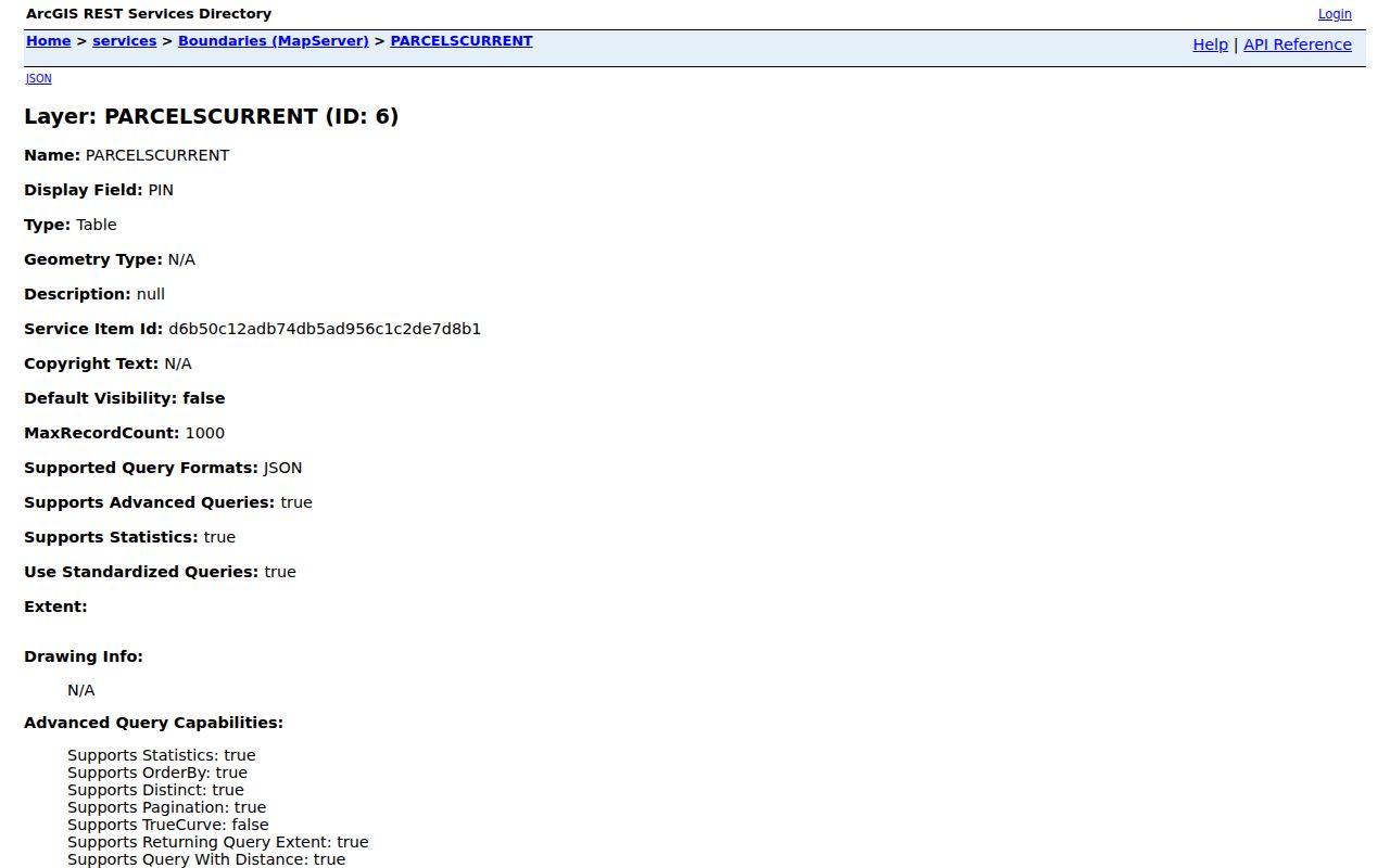
Keeping the location, mailing line, and legal description in separate notes prevents a tax correspondence address from being mistaken for a residence claim.
Note: A homestead or exemption indicator is an assessment field and should not be used to name every person inside a property.
West Chester Township GIS Street Views
The Butler County GIS viewer searches PIN, Owner, or Address and can suggest up to six partial or non-exact matches. A map click identifies one parcel, while point, box, polygon, and freehand tools can limit a geographic selection. Layers for parcels, roads, township or municipal boundaries, flood hazard, and historic imagery add context to a West Chester Township street search. They do not replace the parcel profile or a recorded deed.
The viewer's proximity tool defaults to 100 feet and can use feet or meters with center points or polygons. Choose a small area. The parcel layer has a 2,000-feature query limit, so a broad draw may be less useful than selecting a defined segment of a street. The map output can be printed in PNG, GIF, JPG, BMP, or PDF formats, but a saved image should retain its layer date and be treated as a map reference only.
West Chester Township Records by Street
A West Chester Township street-by-street review combines records that are each keyed a little differently. The parcel PIN and legal description connect property and deed work. The street address supports Auditor, GIS, zoning, and selected historic-directory research. Election material has a different release format, and a directory entry has a date and geographic scope that must be recorded. This table separates what each source can show from what it cannot prove.
| Address record | Custodian | What it can show | Access route |
|---|---|---|---|
| Auditor property profile | Butler County Auditor | PIN, owner label, situs, mailing lines, value, sales, and exemptions | Public search, counter, or phone. |
| GIS parcel map | Butler County Auditor/Engineer | Parcel position, PIN, nearby parcels, roads, boundaries, and imagery | Public viewer; then confirm in the profile. |
| Recorded instrument | Butler County Recorder | Grantor, grantee, document type, recorded date, number, book/page, and legal description | Cloud search, counter, email, or historical index. |
| Zoning or permit file | West Chester Community Development | Zoning and an existing-file context for a parcel or project | Map, tailored records request, or office contact. |
| Election file | Butler County Board of Elections | Lawfully released geographic voter-record context | Election Vault, precinct inspection, counter, or request. |
| Dated street guide | Library or historical collection | Address or householder entry for a surviving edition | Digital collection or in-person research. |
The chain begins with a parcel, not an assumption about residents. A Recorder document is title evidence, a map is geographic evidence, and a dated directory is a historical lead. Their overlap can help verify the right address over time.
West Chester Township Street Deed Chains
Use legal description as the stabilizer when tracing an address through the Recorder. Start with the current owner as a grantee, then match a conveyance by legal description, date, and document number. The grantor on that matching document becomes the next name to check for the earlier acquisition. Instrument type matters. A sheriff deed, certificate of transfer, estate conveyance, transfer-on-death record, mortgage release, plat, or land contract does not mean the same thing as an ordinary sale.
Recorder materials describe online access for documents from 1987 forward and preserve geographic, alphabetical grantor/grantee, historical-book, plat, land-record, and in-lot routes for earlier research. The counter, email copy-request route, and targeted historical search are useful when a modern street label fails. The Recorder does not perform title searches, so bring a specific legal description, book/page, name, or document number.
The Butler County Recorder Advanced Search supplies the party, date, document, book/page, OCR, and legal-area controls used in a West Chester Township deed follow-up.
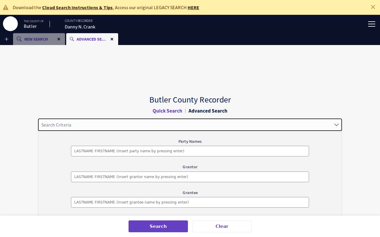
Copy the party role and legal-description match with each instrument. A name alone can produce a false chain when more than one property or person is involved.
Note: For pre-1987 material, a focused counter or email request is stronger than asking the Recorder for a broad property-history compilation.
West Chester Township Zoning Addresses
The Township's Check Your Zoning instructions use the address printed on a property-tax statement or a parcel number. They also tell users to omit the street suffix, click the parcel for detail, and zoom out to see surrounding parcels. The map provides zoning and neighborhood context. It is not proof of title or occupancy, so return to the Auditor and Recorder for those separate questions.
A zoning certificate may be relevant to new construction, additions, remodels, pools, garages, sheds, fences, decks, signs, or a change in use. No anonymous public historic-permit result index was verified. Community Development is the fallback for a narrow existing-record request by address, parcel, application number, fee, or date range. A named applicant, owner, or contractor in a permit file still does not establish who lived there.
The Township zoning certificate application is the source shown for this West Chester Township zoning follow-up.
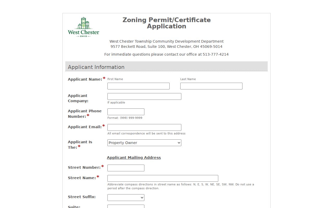
The application helps explain the Township's address and project context, while the property and deed records remain the ownership trail.
West Chester Township Street Voter Files
Ohio's My Voter Information is an individual registration, precinct, and polling-location lookup that requires a first name, last name, and county. It is not a list of everyone on a West Chester Township street. For geographic material, the Board's Election Vault posts a rolling West Chester Township CSV alongside precinct and other geographic files. It is a download listing, not a nearby-address search tool.
Public voter access is limited by Ohio Revised Code 3503.13 and related rules. Full or partial Social Security numbers, identification numbers, phone, email, Safe at Home records, protected addresses, and other protected material are excluded. The Board of Elections also offers a counter and a public-records request route. A missing result does not show that a person is absent from a street; it may reflect confidentiality, release format, or a record outside the search's scope.
West Chester Township Street Name Clues
Historic street research in West Chester Township has a name-continuity problem, not a verified street-renumbering date. The government name was Union Township until June 28, 2000. Older material may use Union Township, Mechanicsburgh, Olde West Chester, Port Union, Tylersville, Rialto, Gano, Maud, Pisgah, or a landmark instead of a current address. Search those terms alongside the current street label, then test every match against a parcel, plat, or legal description.
The Township history records Mechanicsburgh in 1817 and its West Chester renaming in 1826. That local naming shift is useful when an older deed, cemetery entry, atlas, church record, or newspaper does not recognize the present township wording. No authoritative local source supplied a street-renumbering project date, so none should be assumed.
Note: A historic place name is a search term and geography clue, not proof that an old reference maps to one current street number.
West Chester Township Street Directory Terms
Property records use a few terms that make the difference between a careful street-record review and a bad match. The parcel record and the recorded instrument speak different administrative languages, while a dated directory describes a separate household-listing tradition. Keep the definitions with the copied source data.
- Parcel
- A county-defined real-estate unit tied to a PIN.
- Situs address
- The physical property location carried in the parcel record.
- Plat
- A recorded map of subdivided lots, often useful when an old deed lacks a modern street number.
- Criss-cross directory
- A historical reverse or street arrangement from address to listed occupant or householder. A complete local run was not verified.
These distinctions matter most where a parcel has been split, improved, reassigned an address, or described by an older village or subdivision name.
Past Listings for a West Chester Street
There is no verified continuous historic West Chester Township city-directory run. The nearby MidPointe Middletown City Directory Collection covers 1891 through 2000 with documented gaps, and its geographic reach must be checked before it is used for a township address. A Williams 1962 example demonstrates alphabetical, business, numerical-telephone, and street-and-avenue material. A 1996 Polk example includes alphabetical, business, telephone, and street-address sections.
For a dated street listing, copy the volume date, page, street heading, number, name, and any Vacant or No Return notation. Do not turn an old phone, ownership notation, or a nearby-city entry into a current residence claim. The deeper collection and its documented year gaps are available through the West Chester Township city directory record.
Butler County Historical Society, Lane Libraries, the West Chester-Union Township Historical Society, and atlas or plat collections are the stronger in-person and research-request fallbacks when a street guide is missing or the address used an older name.
Limits of a West Chester Street Directory
Address research can document a listed owner, parcel, map position, recorded transaction, or dated directory lead. It cannot reveal every renter, family member, utility customer, delivery record, confidential voter, or protected address. Ohio Safe at Home protects participant address information, and Ohio public-record redaction procedures have separate limits. Motor-vehicle personal information is also restricted. Do not try to reconstruct a suppressed address by combining unrelated records.
Lawful use. West Chester Township street records are for personal, lawful research and civic or family-history questions. Do not use address information to stalk, harass, intimidate, or harm anyone.
When a public record appears wrong, contact the specific custodian with the parcel, document, or case reference and ask about its correction or redaction process. Ohio Public Records Act requests seek existing records; they do not compel an office to create a resident list.